By Aaron Webb
I lived in Leeds, Utah when I a very little child—too young to be cognizant of much. I can’t picture the house; I don’t remember any of our neighbors. But I do have vague memories of the desert, specifically the red rock. I am sure that many of the images that come to my head when I think of my earlier years come from the now-legendary tales of my infant adventures, and not from direct memory, but there are specific images that have always been associated with my years down by St George.
Even after we moved up to Salt Lake City, we continued visiting the deserts of Southern Utah. Much of my dad’s family still lived down there, and we would head to Leeds, Pine Lake, or Black Canyon for family reunions, or just get together with a few uncles, aunts, and cousins and go explore the red rock.
It has been a few years since I have been able to spend consistent time in the Southwest desert as I have repeatedly moved around the country, and out of the country. Iraq is a desert, but without the awesome sandstone that makes up the slot canyons of the Escalante area, or the fins of Arches National Park. Argentina has a wonderful desert up on the northern border with Bolivia, a part of one of the most arid deserts in the world. But it lacks the red rock for which St George and Moab are famous, and the fluted canyons that have drawn tourists from every corner of the globe to Zion National Park.
Only recently, as I have returned to Utah, have I been able to continue my love affair with the desert, taking trips down to the San Rafael Swell, and Moab among other places. I have felt like a wayward son, returning at last to the family that had waited patiently and lovingly for him.
Two weeks ago I had the chance to return to Leeds and St George, my first time back in years. My dad was going down to take pictures of some of the tourist destinations, and my wife, my daughter, and I tagged along with him. Memories of our honeymoon—that is right, you can laugh all you want, but we enjoyed every minute of our honeymoon in the deserts of Southern Utah—came flooding back to us as we dropped down into the valleys below Cedar City. My wife and I marveled again at the awesome glimpses of the Kolob Canyons as we drove down I-15, tucked so cleverly behind the roadside mountains of ‘ordinary’ sandstone and shale.
Zion was not our destination this time, however. We were there to tour Sand Hollow Reservoir and Snow Canyon.
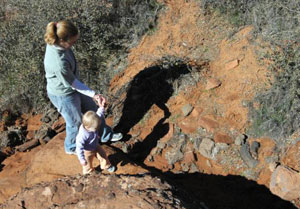
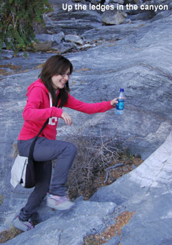
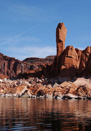
We arrived at Sand Hollow late in the afternoon, just as the winter sun was beginning to sink to the horizon. The red sandstone of the reservoir blazed in the setting sun, contrasting sharply against the dark water and the darkening sky. It was cool, but not cold out, even as the rest of the state readied for another night’s freeze. We only had a half-hour or so to enjoy the scenery before the sun set, so we started scrambling across the red rock on the reservoir shore. We showed Katie (our 15-month old daughter) the bass lurking around the deeper rock-enclosed pools of water, and the hundreds of birds that flocked to the rock-islands out in the middle of the reservoir. She took to climbing the sandstone immediately, and though she needed our help in the endeavor, she enjoyed it immensely and determinedly, refusing to give up. She only fussed when the sun set and we had to take her back to the vehicle.
Our goal for the following morning was to drive into Snow Canyon and find a trail that appealed to us. Though we were not going to take the little girl on a grueling hike, the trail we sought could not be too short, because all of us, even Katie, wanted time to soak up the desert air, and enough mileage to satisfy our itch to explore.
Snow Canyon State Park is gorgeous, 7,400 acres of wilderness consisting of lava-capped plateaus, drifting sand dunes, riparian river bottoms, and the iconic Utah red rock in all of its variety of hoodoos, slots, and spires. There are over 18 miles of hiking trails within the park, along with a well-maintained, full-amenities campground and numerous picnic areas.
We decided on the Hidden Pinyon Overlook, about half-way up the main canyon. It would be short enough to allow us time for other excursions, and to keep the kid happy, but provide a good sampling of the canyon, lava flows and all.
One of the interesting—and potentially—beneficial things about Snow Canyon is how interwoven the trails are. I could hike from the Whiterocks Trail up at the north end, all the way down to Johnson Canyon without touching the main road for more than the one-time, thirty-second period that it would take me to cross it on the way from the Whiptail Trail, towards the canyon.
From the Hidden Pinyon Trailhead, we had the option to follow the Hidden Pinyon loop, or to visit the overlook, or to continue on the Three Ponds Trail, crossing West Canyon Road. Alternatively, we could have headed south or north once we reached the junction with the Whiptail Trail, or entered the Petrified Dunes once we reached its junction.
I would imagine that so many options could seem confusing and disorienting to some visitors, but all of these trails coincide within the same small section of canyon, only 5 miles long, and 2 miles wide, and most of them are within sight and sound of Snow Canyon Drive, the main road that sits at the bottom of the canyon. There are signs placed at nearly every trail intersection, making it easy to judge direction and distance to your destination.
We decided to keep it simple for time’s sake, following along the Hidden Pinyon Trail until it reached the Overlook. There were other hikers on the trail, but not enough to make it crowded, mostly small families. The path was easy to follow and in good repair, but still primitive. I personally do not like hiking trails that are grated and improved so much that they might as well be paved—if that was what I wanted I would be walking on the road. There were some tricky places, where hikers have to duck under an overhang, or scramble between two narrow walls. That kind of hiking adds to the experience in my opinion, and I would have welcomed more. For those who do not enjoy such obstacles, either for problems related to health, age, etc, there are generally secondary routes that go around the obstacle, though I intend on taking the hard way for as long as my aging knees and back permit.
The officials at Snow Canyon, as in so many other areas of Utah, have determined to keep hikers on the pathways and away from the soft sand and vegetation. There are some good reasons for this; desert flora can be very fragile. I know we all imagine the amazingly tough and hardy cacti and junipers when we think of desert flora, even as we tromp through the tiny wildflowers, or the biological soil crust that includes algae, lichens, mosses, and fungi, all vital parts of the arid ecosystem of the desert. There are large sections of bare sandstone for those who are itching to get off of the trails, and the trails themselves are plentiful and interesting enough to sate our wanderlust without having to disturb the environment any more than we have to.
My daughter thoroughly enjoyed the trail, putting more miles on those little legs of hers. She would run away from me when I tried to rescue her from a seemingly difficult section of red rock, preferring to do it herself. I still grabbed her every now and then so that we could maintain a decent pace, more from the fact that she liked to stop and study the bugs, rocks, sand, leaves, and whatever else might have found its way onto the path, than from her not being able to keep up.
Hidden Pinyon Overlook is a bluff that sticks out over the sandstone and lava rock of the West Canyon Road and the Three Ponds Trail. The Overlook itself is capped by black lava rock and scrubby desert brush. The whole Snow Canyon area is one of the gems of greenery that Utah is famous for, tucked into the red and brown folds of the southwest desert.
From where we stood atop the Overlook, the view of the canyon below us opened up impressively. It was very peaceful up there, the only sounds coming from the light winter breeze—remarkably warm despite the horizon-grazing inclination of the sun—and the movement and conversation that we initiated.
Our no-fear daughter was adamant about exploring the very edge of the cliff. It was not a far drop, only 30 or 40 feet before the next tier, but that was enough to make us nervous. Much to her irritation, we kept her away from the bluff, only allowing her to play on the rocks on the trail.
All too soon it was time to head back. We still had a few other places to visit before the short winter day was through, and it was now early afternoon. The hike back down the trail was quicker—we had already explored all of the eye-catching scenery that we could find along the way up, and Katie was tired, so we carried her instead of letting her set the pace.
With Katie and my dad resting in the car, Rebecca and I took a stroll to the Sand Dunes to enjoy some leisure time before leaving the canyon. The Sand Dunes sit at the base of the canyon, below West Canyon Road, and beside Jenny’s Canyon. The area of the dunes is rather small, only a few hundred feet wide, and 1,000 feet long, but still sufficiently large enough to roll down the sides of the dunes, or to play football on the flat stretches. The picnic area is directly above the dunes, as are the restrooms.
There are a number of other amazing hikes within the small confines of Snow Canyon. West Canyon Road is the longest hike among the many within the canyon, open to hikers, joggers, and bikers. It extends from the Sand Dunes to the upper end of the park. The Cinder Cone Trail at the north end of the park takes visitors to the top of a 500-foot cinder cone crater, one of a few that are part of the Santa Clara Volcano, a field of volcanic activity that covers all of St George. Jenny’s Canyon is a small slot canyon just across the road from the Sand Dunes. It is short, easy to get to, easy to navigate, and makes a great candidate for an afternoon of exploration.
 I'll be heading out on a little trip tomorrow, starting the new year off right. I want to take photos of the lowest point in Utah, a spot in Beaver Dam Wash southwest of St George.
 (See
(See 
 An AP news article about the sale of oil and gas leases near Utah national parks is being widely published, and is causing a bit of uproar. The sale is controversial and should be examined. Unfortunately, the AP article includes several misstatements, some so distorted they reek of sensationalism.
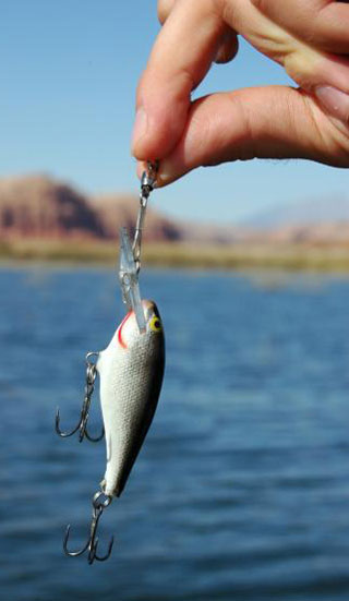
 The afternoon was a beautiful today, sunny and warm, and I really wanted to spend a few hours fishing from my boat.
 The White River flows alongside Hwy 6 on top of the mountain east of Soldier Summit. The White River has water quality problems and is not considered much of a fishery there along the road.
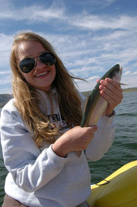 I'm hoping to take the boat up to Scofield for a little fishing tomorrow - I'll go if the weather isn't too bad.
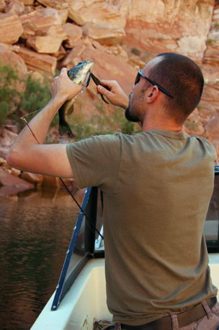
 With the weatherman forecasting beautiful conditions later this week and this weekend, I'm scrambling to plan trips to take advantage of what could be the last summer-like weekend.
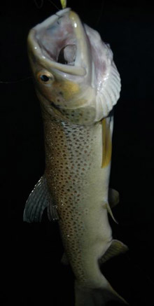
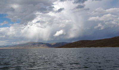 Went to Strawberry today to shoot video at scenic points around the reservoir. It was a fun trip and we got some good stuff. We fished for a few minutes but didn't catch anything to brag about. Little fish.
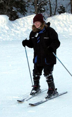 What did I do well? I went fast, very fast. Stopping, on the other hand, proved a tad more difficult for this first time skier.
  So with boots, poles and slender pieces of composite material, we headed off. In an effort to ward off the cold I did what any supply-lacking, warm-blooded (and intelligent) person would do: I dressed in layers. Unmentionables, long johns, jeans and sweatpants covered my bottom half while the turtleneck, shirt, sweater and coat engulfed my top. Now, you can laugh, but of all the things I was that day, I was not cold.